Consultancy Units
Surveying Engineering Studies and Consultancy Unit
Unit's Objectives
The unit aims to serve the community and contribute to all studies and consultations, and executive and field work in all disciplines of surveying engineering. The unit provides advisory services to governmental or private entities, or to executing companies and natural persons.
Beneficiary Categories
- Graduate students and college students.
- Urban Communities Authority – Ministry of Housing, Utilities and Urban Communities.
- New Cities Authorities (New Administrative Capital - New Obour City - New Warraq - New Alamein - ... etc.).
- Research and Reconstruction Studies Authority.
- Landowners in new cities (expansions of Sheikh Zayed - Qadisiyah - Hope - 6th of October - ...... etc.).
- The Executive Authority for Greater Cairo Projects and Reconstruction.
- Contracting companies of all categories (Arab Contractors (Osman Ahmed Othman) - Egyptian Joint Stock Contracting Company - ..... etc.).
Engineering Services Provided by the Unit
- Production of detailed and topographic maps using traditional ground surveying methods, using aerial photographs or using satellite imagery.
- Surveying works for roads, water and sewage stations and lines and for large structures such as dams, reservoirs and bridges.
- Study the movements of installations and buildings during and after implementation, concrete and metal bridges under the influence of loads.
- Study and adjust the verticality of buildings and high towers during and after the implementation work.
- Producing databases for geographic information systems and converting paper maps into digital maps.
- The use of remote sensing system in various projects.
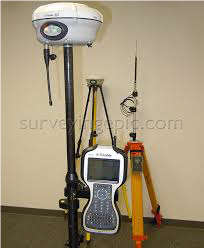
- Various cadastral applications of monitoring with GNSS receivers.
- Carrying out water survey works for water installations such as ports and beach protection works.
- Surveying works for dust formation, leveling, mechanical and electrical installations.
- Calculating the quantities of dust operation and preparing reports (periodic and final) for this.
- Calibration and adjustment of all surveying devices.
- Organizing training courses in the fields of surveying and producing maps using surveying devices.
- Land division, property determination and valuation of assets and plots of land owned by banks, companies and individuals.
- Establishment of ground control point networks.
- Documenting the facades of archaeological and historical buildings and producing vertical, horizontal and three-dimensional binoculars for them using a scanner (Laser Scanner).
- Scientific research service in all cadastral disciplines.
Unit's Prequalification
- New City of Alamein in Marsa Matrouh Governorate.
- Green River area in the New Administrative Capital.
- The location of the military entity in the New Administrative Capital.
- Development project for the university campus of Ain Shams University and its hospitals.
- The first urban assembly on the regional axis north of Wadi Al-Natroun - Al-Alamein road.
- Follow-up landing to the Children's Hospital in Demerdash.
- Monitoring and processing 28 GPS points for the Dabaa nuclear plant.
- Cadastral survey of the boundaries of the regulation line from the beginning of the City of Alamein to El Alamein Airport - New City of Alamein Authority.
- Cadastral survey in the Ain Al-Sira lakes area.
- Network budgets for the national project for the new administrative capital with an area of 200,000 acres.
- Cordon New Heliopolis City.
- Ground control points for maritime navigation works in the Abu Rudeis fields area.
- Cadastral works for the turbid water line Al-Muneeb - 6th of October City, with a length of 15 km.
- Surveying the planimetric features and preparing detailed maps of land allocated to the Nuclear Materials Authority in Abu Zenima, South Sinai Governorate.
- Monitoring and following up the movements of 5 buildings in social housing in the new city of Sohag.
- Loading experiments for bridges and measuring the formations of El Alamein bridges in the new city of El Alamein.
- Surveying the facades of Ain Shams University hospital buildings using a scanner.
Unit's Website/Link
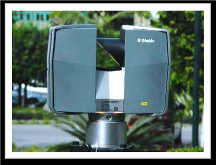
Laser Scanner
Global Positioning Systems (GPS)
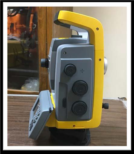
Motorized Total Station
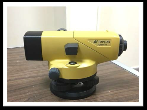
Ordinary and Precise Level
